Arecibo


1 / 2
File stampabili (1)
-
 stl
stlArecibo.stl
60.9 Mo · 455 download
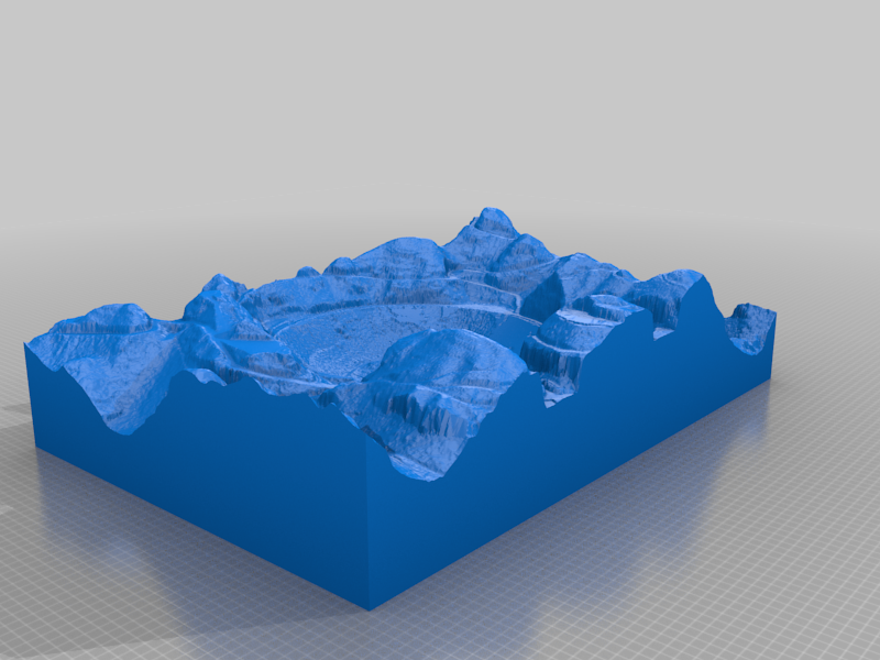
Descrizione
Arecibo constructed using 1 meter resolution LiDAR data from NOAA. Notice that the LASER makes it through the screen reflector except for some of the outer edges where the angle is steep and therefore it hits just screen. Because of this you can see the access road that travels underneath the reflector. This map has about 1.3 million facets/polygons. I made this using new software I wrote for processing LiDAR data.